|
The name Aerotri appears for the fisrt time as an aerotriangulation adjustment piece of software
the year 2003. Already back in 2003 it included a rigorous treatment of cartographic projections, a block adjustment
using robust estimators and the possibility to include GPS events from the plane. Soon afterwards the possibility to
incorporate inertial data was added.
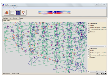
The program kept steadily growing: self-calibration, graphic of the flight, more input and output supported formats...
The ever growing use of UAVs for the making of photogrammetry has lead to the use of cheaper software
packages, integrated as a monolithic bundle, easier to learn yet providing very little if any compatibility between
one another. It is therefore that Aerotri started offering services in order that operators could reuse the
output from a program in a different one. A typical request was to transform an Image Master or RapidCal camera
file into a Digi one.
The year 2017 saw the software being released for free. On the other side, the software's develpment is on stand by since
approximately 2016.
|


 aerotri@aerotri.es


